
Find Me, Find the Map
The Blueprint · Shipped, then reverted 2021–present
- Role
- Platform Architect / Sole Engineer
- Timeframe
- Web application era, after geocoding was in place. Exact release not sourced.
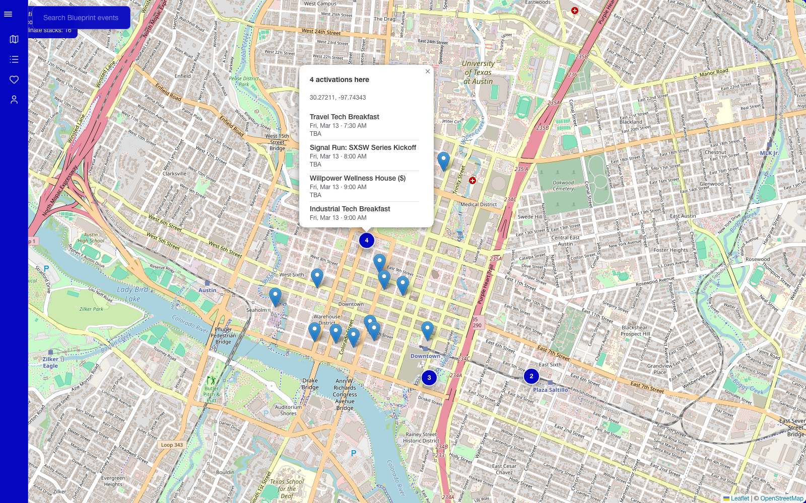
Made finding the map part of the experience: an Instagram story offered a clue to a hidden route, while a feature flag controlled access.
About the project
The Blueprint is a free SXSW event guide for Austin whose community, editorial voice, and trusted spreadsheet predate the software. I began building the web application in 2021 and have owned its product and technical implementation end to end since.
- Organization
- When Where What
- Timeframe
- 2021–present
- 80,382
- Registered users
- 4,304
- Activations across years
- 358
- Staff picks
Overview
A map outside the main navigation
During SXSW, event information becomes more useful when you can see where the venues are relative to one another. I built a map for the Blueprint, but I kept it out of the main navigation and shared a route named after me: /gideon.
The product was free and had a concentrated annual traffic spike. I wanted to offer the map without immediately making it a prominent destination for the whole audience. A feature flag let me enable it deliberately, while the hidden route made discovering it part of the experience.
Solution
Controlling how the map was reached
The Instagram story was the invitation. “Find me, you’ll find the way!” pointed toward the person behind the feature instead of handing readers a navigation link. The route was /gideon: finding me in the URL was how you found the map.
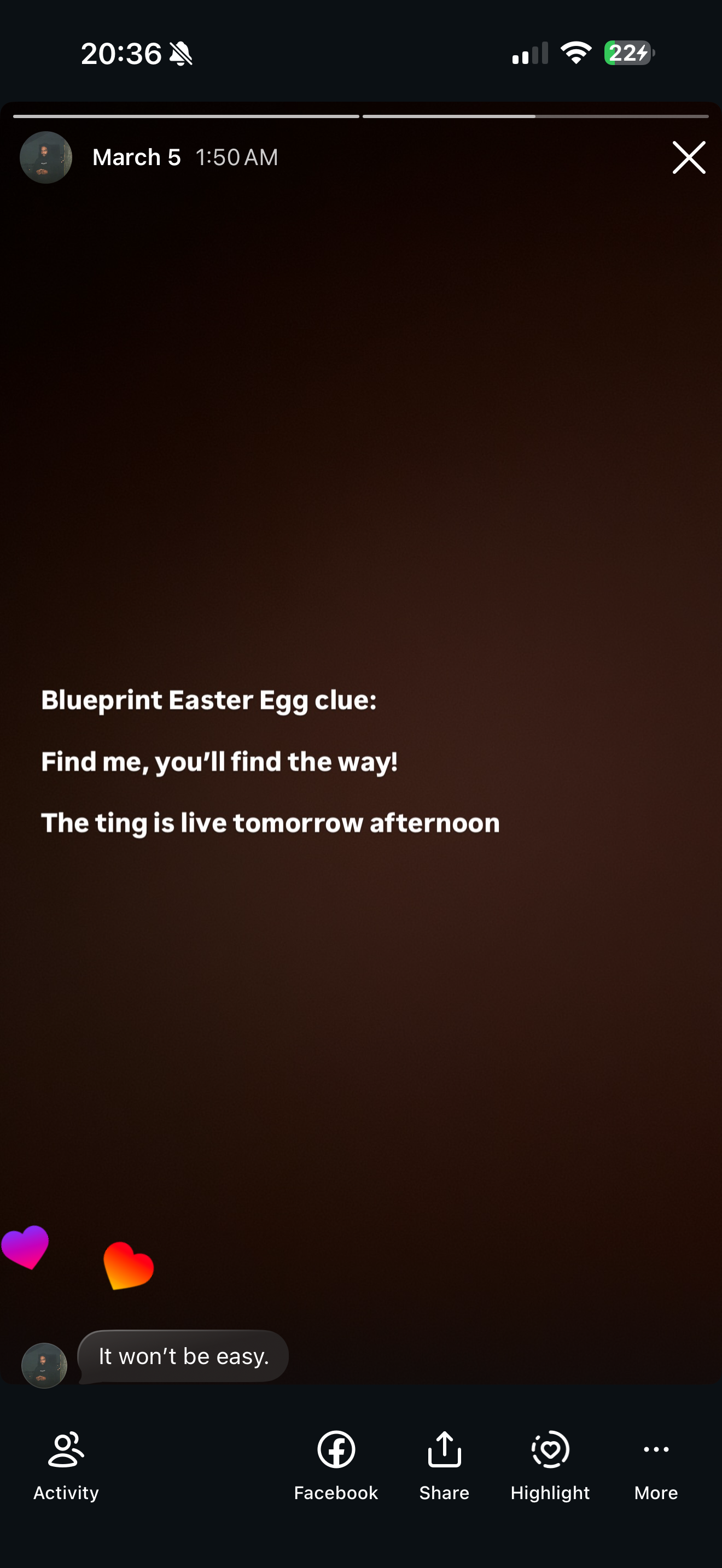
The story did not spell out the route. That small gap between the clue and the destination made discovery playful, but it also meant a useful feature could be missed. This was part of the distribution decision, not just a technical gate: the story gave people a reason to look for something the navigation did not reveal.
I considered putting the map in navigation. That would have made a useful feature much easier to find, but it also increased the exposure of an interface whose tile usage I had to account for. Leaving it unbuilt would have avoided that work and left the geographic problem untouched.
The route checked the map flag and redirected to the map page only when it was enabled. Otherwise, it sent the visitor home. This illustrative example shows the decision without exposing the production route or flag names:
Illustrative pseudocode; names and paths are placeholders, not a production source excerpt.
The actual implementation also checked access at the destination and required authentication. Search metadata kept the page out of ordinary indexing. Those controls served different purposes from the clue itself.
Those choices reduced ordinary discovery. They did not impose a numerical usage limit: someone could share the route, and search metadata was not an access control. The flag and session boundary determined whether the page could be reached; the absence from navigation affected whether someone would find it.
Choosing the map implementation
Potential tile costs influenced how widely I wanted to expose the map. I considered Mapbox while planning it, then built the feature with Leaflet and OpenStreetMap tiles. Keeping discovery limited and choosing the map implementation were related decisions, but they solved different parts of the problem.
The hidden route gave me a way to introduce the feature without putting it in front of the whole audience at once. It did not set a hard usage limit. I did not retain the usage or billing figures needed to measure the effect, so I can explain the intention without claiming savings.
The map also depended on coordinate data. Activations without latitude and longitude were omitted. Their coordinates could be entered through Strapi or produced by geocoding; displaying the map did not resolve missing locations.
Showing what shared a location
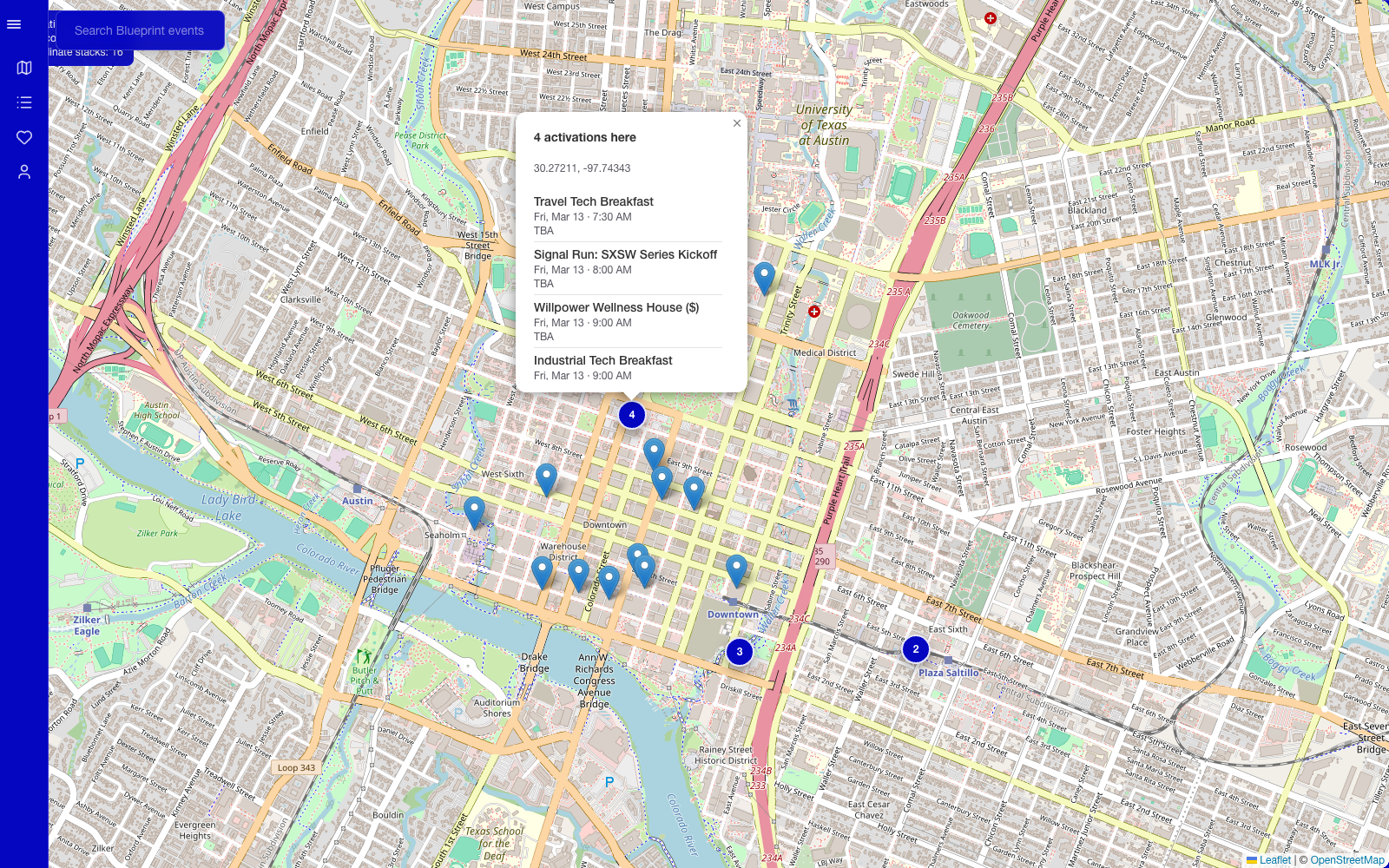
I loaded the activations for the default main event across the available pages, then grouped those with coordinates by latitude and longitude rounded to six decimal places. Several activations at the same venue became one marker with a count, rather than overlapping pins.
Opening that marker showed the activations at the location. A single location centered the view; several locations fitted the map bounds. This made the map useful for comparing the day's possibilities while retaining the individual listings behind each point.
Leaflet loaded on the client. When the sidebar changed the available space, I invalidated the map's size so it could measure the new layout. That detail kept the map aligned with the surrounding interface.
- Instagram story
“Find me, you’ll find the way!”
- Follow the clueDiscover /gideon
The clue does not print the URL.
- Request the hidden routeFeature enabled + signed in
Flag off redirects home.
Authentication protects the map.
- Access checks passBlueprint map
Activations grouped by location.
Reflection
The cost of making a useful feature hard to find
Several people told me during the festival that they had found the map. That is the feedback I have; I did not retain usage figures that would tell me how many people found it or used it successfully.
I also accepted a substantial product cost: many readers would miss a feature that could help them navigate. The community's voice made the clue feel at home, but that did not remove the discoverability tradeoff. The decision to gate distribution was mine; that voice belonged to Chris Cates and the Dirty Team community.
The Leaflet implementation was later replaced by a placeholder behind the route and gates. This account describes the version used during the festival, not a currently deployed feature.